01 Challenge
The product problem
Urban-planning decisions combine transport, environmental risk, development proposals and stakeholder input. Traditional presentations make it difficult to explore how those layers interact in a specific location.
Client/Sector: Simam Digital / civic-planning POC
A collaborative urban digital twin using live map context, scenario layers and multimodal route planning.
Project Snapshot
01 Challenge
Urban-planning decisions combine transport, environmental risk, development proposals and stakeholder input. Traditional presentations make it difficult to explore how those layers interact in a specific location.
02 Approach
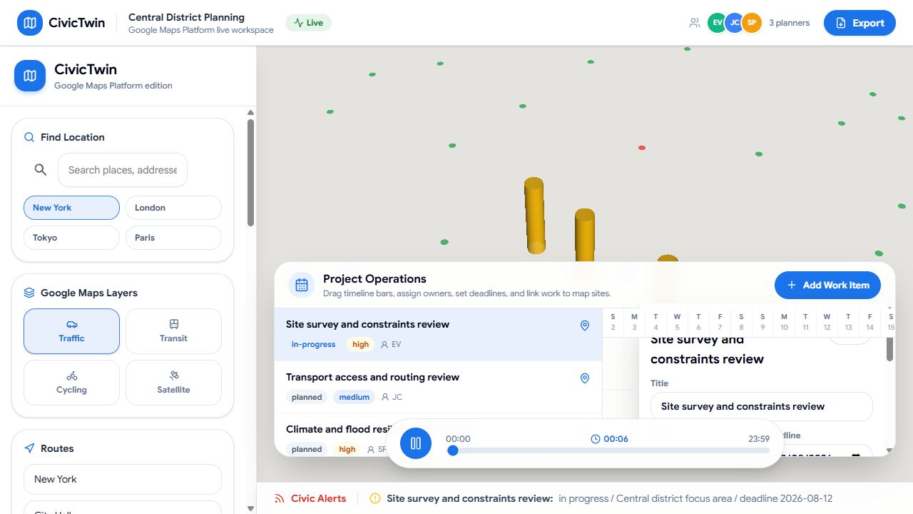
I designed CivicTwin as a working planning surface rather than a static dashboard. Users can change cities, toggle map layers, compare travel modes and explore simulated mobility, congestion, heat, flood and EV-planning scenarios.
03 Execution
The interface combines Google Maps context with scenario controls, routing tools, planner presence and export actions. The product is presented as a professional Simam Digital POC using demonstrative data, suitable for discovery without exposing confidential client detail.
04 Outcome
CivicTwin shows how spatial products can turn complex place-based evidence into a shared visual conversation. It demonstrates map integration, dense interaction design and collaborative product thinking across councils, consultants and infrastructure teams.
Technical delivery
CivicTwin explored planning as a collaborative spatial workflow: combine map context, proposed change, mobility and measurable impact so different stakeholders can discuss the same scenario.
Existing conditions, proposed development, transport, constraints and points of interest were treated as independently controlled layers with shared coordinates. That allowed users to build an argument progressively and prevented the interface from presenting every dataset at the same visual priority.
Planning comparison requires users to understand which assumptions are active. Scenario state captured selected proposals, routes, measurements and visibility so alternatives could be revisited without reconstructing the view. The approach also creates a future boundary for saved projects, comments and permission-controlled collaboration.
Multimodal routing added practical consequence to a visual proposal: how walking, road or transit relationships changed around a site. The POC demonstrates how geospatial services, UI state and planning narrative can be combined without implying that representative public data is a statutory planning model.
Project summary
No. It is presented as a self-hosted Simam Digital product or NDA-safe proof of concept without identifying confidential clients.